INSUBCONTINENT EXCLUSIVE:
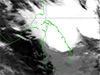
The low-pressure area in the southeast Bay of Bengal is highly likely to intensify into a depression over the next 48 hours, the Department
of Meteorology says.It is expected to move west-northwestward, closer to the northern coast of Sri Lanka and towards Tamil Nadu area by
November 20 and 21.Showers will occur at times in Eastern Province
Fairly heavy showers above 50mm can be expected in some places.Several spells of showers will occur in Northern and North-Central
provinces.However, mainly fair weather will prevail elsewhere in the country.Strong winds of about 40-50 kmph can be expected at times over
the Northern, North-Central and Eastern provinces.Misty conditions can be expected in Sabaragamuwa, Uva and Central provinces in the
morning.Sea areas:Due to the low-pressure area in the southeast Bay of Bengal, the naval and fishing communities are advised not to venture
into the deep and shallow sea areas off the coast extending from Kankesanturai to Batticaloa via Trincomalee and Bay of Bengal Sea area
until November 21.Showers or thundershowers will occur at times in the deep and shallow sea areas off the coast extending from Kankesanturai
to Batticaloa via Trincomalee.Winds will be northerly and the speed will be 25-35 kmph
The wind speed may increase up to 45-50 kmph at times in the sea areas off the coast extending from Kankesanturai to Pottuvil via
Trincomalee and Batticaloa
The wind speed can increase up to 40 kmph at times in the other sea areas around the island.The sea areas off the coast extending from
Kankesanturai to Pottuvil via Trincomalee and Batticaloa will be rough at times
The other sea areas around the island will be fairly rough at times.
This article first appeared/also appeared in https://adaderana.lk