INSUBCONTINENT EXCLUSIVE:
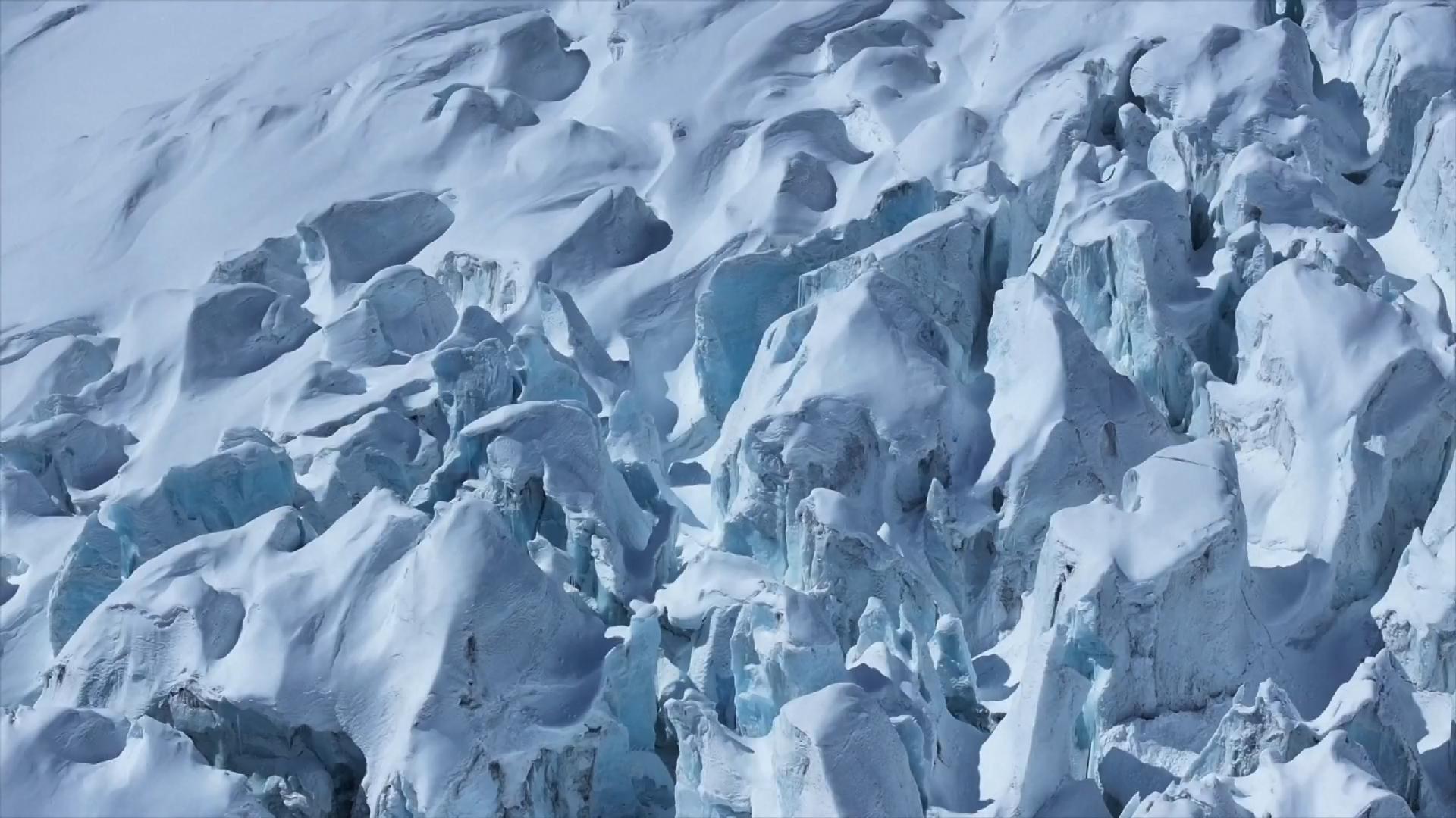
After a day of wind and snow, the skies cleared over the Renlongba Glacier in southwest China's Xizang Autonomous Region on Thursday,
creating perfect conditions for a low-altitude helicopter to take off for China's first airborne survey of marine glaciers.Launched earlier
this week, the survey aims to investigate the development patterns and melting changes of marine glaciers and provide data support for
natural resource management.Marine glaciers refer to natural ice bodies that have existed for many years on the surface of polar or high
mountain regions and can move along the ground
The first survey point for this airborne investigation is the Renlongba Glacier in Qamdo City, Xizang.Xiong Shengqing, chief scientist at
the Natural Resources Airborne Geophysical and Remote Sensing Center of China (AGRS), confirmed that the helicopter is outfitted with two
rectangular devices mounted on either side of the fuselage
These are aerial ice-penetrating radars that emit high-frequency electromagnetic waves and can reveal the internal structure of glaciers
The helicopter also carries a homegrown airborne gravimeter that can determine glacier thickness by detecting subtle density differences in
the bedrock beneath the ice."Our gravimeter has achieved world-class precision," said Xiong, "while being only one-third the size of
comparable foreign instruments."Following the Renlongba Glacier survey, the helicopter will travel to other key glacier zones across
southeastern Xizang over the next two weeks, covering roughly 1,000 square kilometers, according to Xiong
The full results of the mission are expected within three to four months.Remote sensing satellites for glacier surveyTwo Gaofen satellites
were deployed to scan and photograph the Renlongba Glacier, according to Wang Shanshan, a senior engineer at AGRS
These satellite data offer wide coverage and rich detail, enabling scientists to rapidly determine glacier boundaries, elevation changes,
and surface motion."By combining high-precision satellite imagery with terrain data, we've built a detailed 3D model of the glacier," said
"These 3D datasets help us study glacier movement mechanisms, run simulations, and even probe beneath the ice surface — an essential
foundation for further research."This three-dimensional approach, spanning space, air and ground, marks a first for China in marine glacier
observation."Marine glaciers, also known as temperate or warm glaciers, have a higher ice temperature and distinct characteristics
They freeze and melt rapidly, and their movement patterns are quite evident," said Wang.Marine glaciers are subject to variable climates and
complex topography, making data collection extremely difficult
The airborne survey addresses the challenges of high altitudes, low temperatures and vast areas by integrating satellite, aerial, and
ground-based methods into a comprehensive monitoring system.By exploring marine glaciers, scientists can better understand the processes
behind global climate change, providing a scientific foundation for addressing its impacts.